THE RIVER SUIR
The river Suir and its tributaries played a pivotal role in the development of Carrick-on-Suir as well as the fortunes of the Tinvane Dowleys. It is therefore worthwhile providing a description of the river and its land marks from the sea to Carrick-on-Suir.
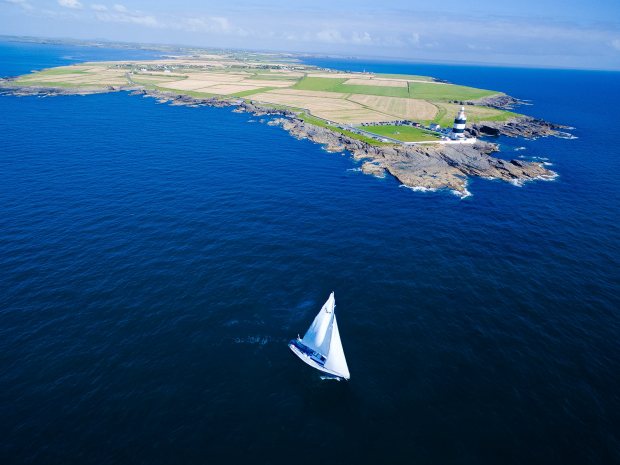
The Suir is a majestic river stretching 183 km from its source in the Slieve Bloom mountains to Dunmore East at the mouth of the estuary5. Waterford harbour is a great natural harbour and during the period of sail was capable of providing a safe haven for the biggest sailing ships of the day. The first landmark that the incoming mariner will encounter is Hook Head and its historic lighthouse on the Wexford side of the harbour. From Hook Head to Dunmore East in Co. Waterford, the estuary is some 5 km wide.
Hook Head, Co Wexford
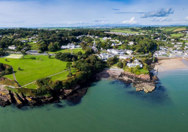
Dunmore East Village & Harbour, Co. Waterford
Lady’s Cove & Lalor’s Strand, Dunmore East
People from the Iron Age established a promontory fort at Shanoon. The fort overlooked the harbour and was referred to as Dun Mor or the Great Fort. Unfortunately, the remnants of this fort was destroyed during the construction of the new harbour.

The derelict pilot station at Shanoon, Dunmore East (2009)
In about 1640, Lord Power (de la Poer) of Curraghmore, who owned a large amount of property in the area, built a castle on the cliff at Laweesh overlooking the Lawler’s strand and Ladies Cove about two hundred metres due north of St. Andrew’s Church5. The castle must have been a beautiful sight, but by the middle of the next century it collapsed into the sea and now just a piece of the wall and one tower remains. This tower forms the boundary of “Cove Cottage” (The Carlow Dowley’s summer house) and is built of red sandstone and eroding rapidly. The original Castle was probably also built of red sandstone which might explain why it fell into ruin so rapidly.

Promontory at Laweesh between Ladies Cove and Councilors Strand where the de la Poer Castle was originally situated in 1460 (part of wall still remains)

The round tower at Dunmore East which was part of the de La Poer Castle
In the winter of 2010 there was another major rock fall from the Laweesh promontory above Peig’s Rock. This most recent fall has put the existence of some of the property in the area in extreme danger. Further erosion in the Laweesh area suggests that rock falls will be a regular feature of the promontory in the future.
Lord Waterford is also reputed to have constructed the original building overlooking the harbour (the hotel) as his summer residence. He also constructed Curraghmore Terrace in the lower village to house his staff which he brought from Curraghmore when in residence in Dunmore.
In 1814, dramatic changes took place when Alexander Nimmo, the Scottish engineer (builder of Limerick’s Sarsfield Bridge) commenced work on the new harbour at Dunmore to accommodate the packet station for the ships which carried the Royal Mail between England and Ireland. The building which overlooked the harbour was originally Lord Waterfords summer residence and then an hotel before being converted to a convent and then back to an hotel again and currently (2009) holiday apartments.
The work consisted mainly of a massive pier or quay with an elegant lighthouse at the end. Nimmo’s original estimate had been £20,000 but at the time of his death in 1832, £93,000 had been spent and the final cost was £108,000. By then (1837), the Harbour had started to silt up, and the arrival of steam meant that the winding river could be negotiated easily, so the packet station was transferred to Waterford.

Dunmore East harbour showing the hotel above the harbour (circa 1900)
These changes meant that the great sheltered harbour of Dunmore East gradually reverted to an important fishing and leisure port. Dunmore East is now one of the five designated National Fishery Harbours, and has the second highest figure for fish landings after Killybegs.

Dunmore East Harbour (circa 1900)

Dunmore East Harbour (August 2009)

The Suir estuary from Dunmore East to Creadon Head on left and Duncannon in the distance
The “Wind Scurf” cruiser moored off Dunmore East Harbour
As you progress upstream from Dunmore East, the estuary gradually narrows as it passes Creadon Head and Woodstown on the Waterford side of the estuary. The first defence strucure that is encountered is at Duncannon, on the Wexford side of the estuary. The fort at Duncannon was a major defencive structure guarding the entrance to Waterford harbour. It was built in 1588 as a defence against a possible attack by the Spanish Armada. It was extremely well protected and in late 1649 a detachment of Cromwell’s army was sent to take the fort. Afer a number of unsuccessful attempts they abandoned their mission and marched on to join the main army in capturing New Ross.
During the rebellion on 1798 it was used as a temporary detainment centre before the prisoners were sent across the river to the Geneva Barracks where they were sentanced and executed or inprisoned. The prison was renowned for its cruelty and was abandonded in 1824 after the Nepolianic wars.
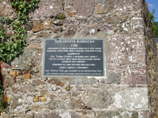 The inscription on the wall of the Geneva Barracks
The Fort at Duncannon was later used by the British to defend the harbour during World War 1 and later again by the Irish Government during the “Emergency” of World War 2.
Aerial view of Duncannon Fort
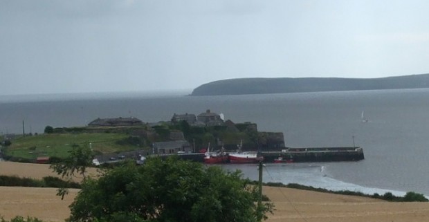
The fort at Duncannon looking back towards Creadon Head and the Hook.
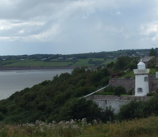
The last lighthouse (now disused) just upstream fom Duncannon
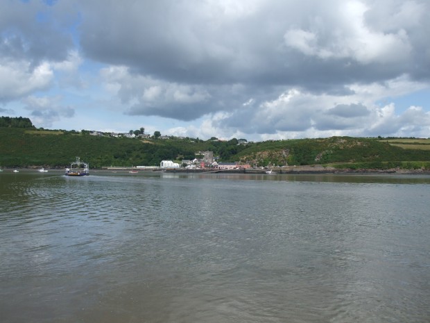
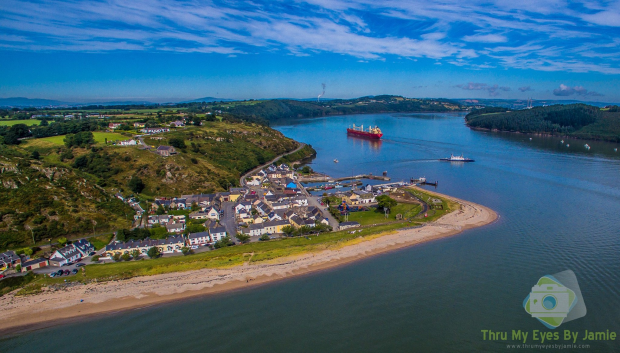
A few kilometers upstream from Duncannon you pass the old fishing village of Arthurstown in Co. Wexford. Shortly after that is the village of Ballyhack which is currently the embarkation point for the ferry crossing to Passage East in Co. Waterford.
The village of Ballyhack in Co. Wexford.
The Castle at Ballyhack overlooking the river Suir
When you pass Passage East the river widens slightly again and the whole estuary is navigable by the largest of ships.
Arthurstown on left with ferry crossing from Passage East on right
Passage East and ship heading upstream to Cheekpoint
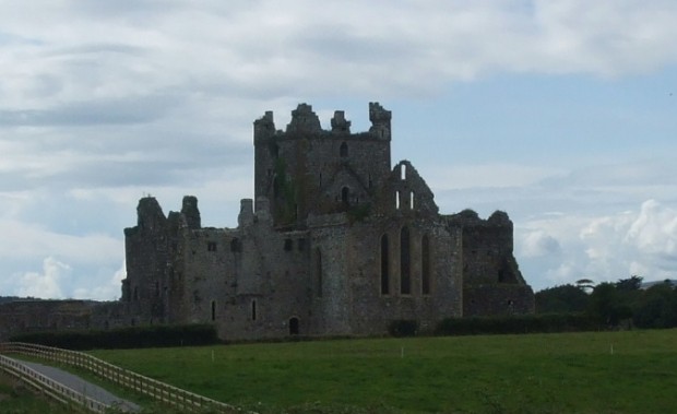
Before you reach Campile you can see the ruins of the Dunbrody Abbey, an old Cistertian monastery on the Wexford side of the river.
Dunbrody Abbey, Co. Wexford
The Barrow & Nore flowing under the railway bridge to join the Suir on their way to the sea
At Cheekpoint the river is joined by the rivers Nore and Barrow but it remains a very expansive river all the way west to Carrick-on-Suir. The vastness of the estuary together with its tidal nature made Waterford a strategic location as well as a major commercial centre. The harbour was able to take the biggest sailing ships of the day and later the bigger steam ships.
Bellferry, the new port of Waterford just upstream from Cheekpoint
Just above the Belferry Port, you encounter “The Island” with the King’s Channel to the south and the new channel to the north. The latter is the channel normally used to enter the old port of Waterford which is now used mainly for the smaller cruise ships, the tall ships and visiting naval vessels.
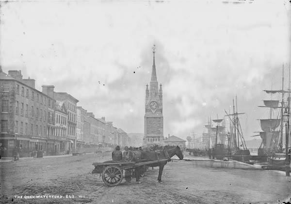
The quay in Waterford in the days of sail
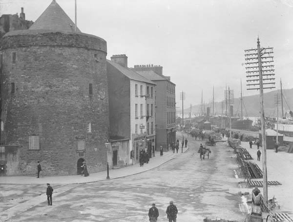
Reginald’s Tower and the quay Waterford in the early days of the steam ships

A large sailing ship at anchor in Waterford (Circa 1900)
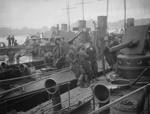
Prior to WW1, Waterford harbour was considered to be a major strategic facility for the British navy. As a result, British warships were seen coming and going to the port of Waterford on a regular basis. In preparation for WW1 there was a major gathering of British navy vessels in Waterford harbour during 1910 to carry out naval exercises with a view to protecting the harbour against possible attack.
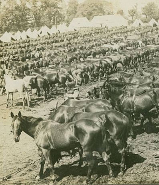
Horses assembled in the Peoples Park, Waterford, before departure for World War 1

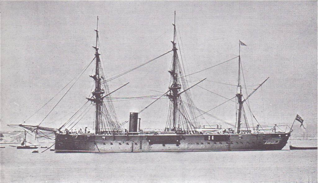
A large British naval ship moored at south quay Waterford
Prior to WW1, the presence of British warships was a common site in Waterford port. Waterford harbour was considered to be of strategic importance to the British navy, especially in regard to the safe passage of food from Ireland to the UK. In anticipation of WW1 a major naval exercise was carried out in Waterford harbour by the British navy in 1910 (see photos above). The purpose of this exercise was to put in place adequate strategies to prevent a German attack on the harbour.

Busy port scene from Waterford (circa 1900)

The cross channel ferry, the “Great Western”, moored near Reginald’s Tower, Waterford
The “Great Western” operated between Waterford and Fishguard around the middle of the twentieth century, carrying goods, livestock and passangers. It made three sailings per week and it was on this vessel that many people from Carrick-on-Suir made their way to England to seek work. For some, this emigration was permanent while for others it was seasonal. As a child in the late 1940’s, I recall looking out the window of the Adelphi Hotel where I watched the unfortuate passengers boarding the “Great Western” and thinking how lucky I was that my own family was spared this sad predicament.
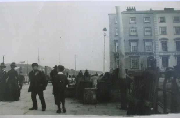
The Adelphi Hotel on the quay beside the cross channel ferry berth (now the Tower Hotel)
The photographs of Waterford harbour around 1900 confirm that the port was a serious centre of commercial activity for all of the nineteenth century. Road transport was extremely limited at that time and there was a great dependence on water transport. As the river was tidal and very navigable up to Carrick-on-Suir, it is not surprising that the commercial activity on the river extended westwards to Carrick and Clonmel.
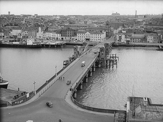
There have been a total of three bridges constructed at the same site on the quay in Waterford. The first timber bridge (Timber Toes) was constructed in 1794. This required the compensation of the ferrymen who, up to this date transported all traffic from the north to the south shore of the river at Waterford. The second bridge (Redmond Bridge) was completed in 1913 while the third bridge was completed in 2005.
The significant factor with all three bridges was that there was a lifting section to permit the passage of the larger boats up the river. As this would have been a difficult and expensive engineering feat in the early days, it shows the importance of the commercial river trade up-stream from Waterford. As Carrick-on-Suir was the only tidal town west of the bridge in Waterford it confirms the importance of the town in the river trade at that time. It should also be mentioned that there were regular wharfs along the river for the purpose of unloading coal which would also have been important in allowing larger ships to navigate the river upstream of Waterford.

The first timber bridge at Waterford completed in 1794 showing a large vessel passing up the river (circa 1900)

The “2nd New Bridge” completed in 1913 and named Redmond Bridge
The first two bridges would in time promote the increase in road traffic to Waterford at the expense of the commercial viability of the river traffic.
The second bridge post WW2

The “3rd Bridge completed in 2005

Close up of the lifting section of the third bridge in Waterford (2009)
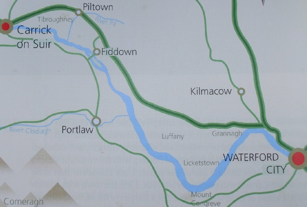
Map of river between Waterford and Carrick-on-Suir
On leaving Waterford the first landmark that you meet is the old steel railway bridge. This bridge once carried the rail service from Waterford to Dungarvan which has been closed for many years.

The old railway bridge crossing the Suir east of Grannagh
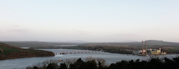
Just above the railway bridge you will encounter the new suspension bridge which allows Waterford to be by-passed by traffic moving from Kilkenny to the south coast. This bridge was opened in October 2009.

The new suspensionbridge near Grannagh Castle nearing completion in July 2009
The next major landmark is the Butler Castle at Grannagh. This is at the beginning of a very expansive 5 km stretch of the river known as the long stretch which brings you up to Mount Congreve. This is facing south-west into the prevailing winds and can get extremely rough in high winds. Consequently it has been re-christened the “long wretch”.
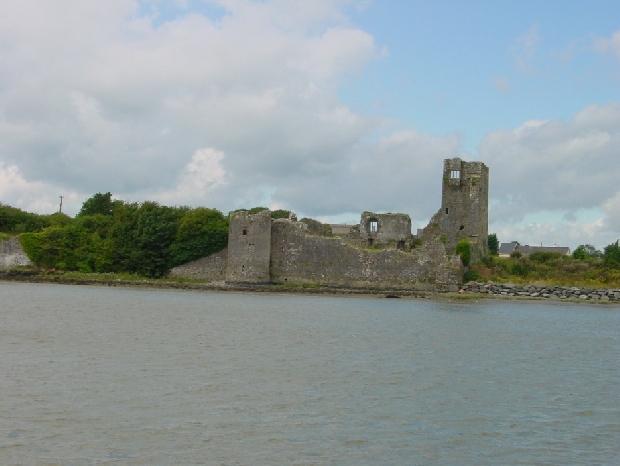
Grannagh Castle from the river

The major expanse of the river Suir from Grannagh Castle to Mount Congreve

The river Suir from Grannagh to Mount Congreve and on to Fiddown
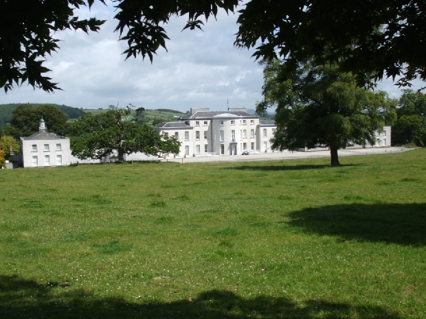
Mount Congreve
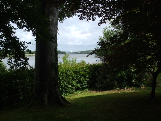
A view of the river Suir from Mount Congreve looking down river towards Waterford with the new toll bridge in the background
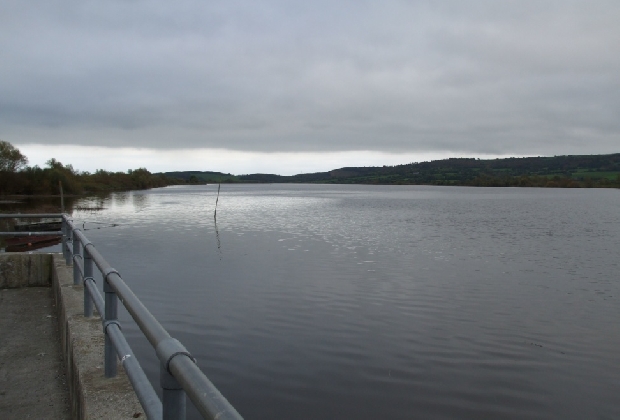
The quay at Polerone near Mooncoin

Rockets Castle and the Russian House on the southern bank below Fiddown

Fiddown bridge (northern section) and Morris’s quay, navigation was normally through the southern section
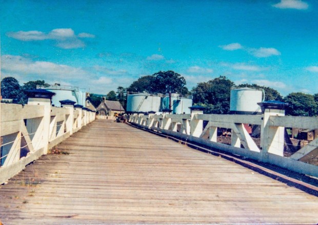
The old wooden Fiddown toll bridge
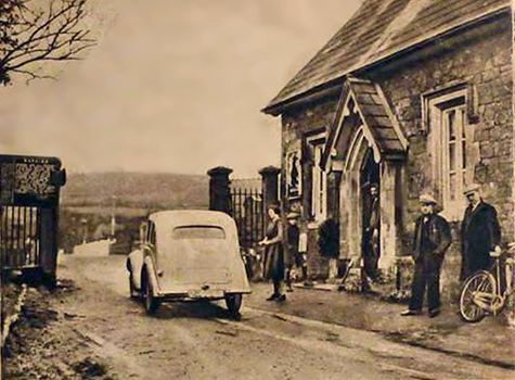
Toll (3d) being taken at Fiddown bridge

Tybroughney Castle on the northern bank of the Suir 3 km east of Carrick (currently occupied by Louis & Daphne Dowley)
As you approach Carrick-on-Suir at low tide you come across the shallows which is the first real impediment to navigation on the whole journey from Waterford. The shallows are only visible at low tide and in the past the boats had to anchor below the shallows and wait for high tide before entering the harbour of Carrick-on-Suir just east of the old bridge.
The Suir Navigation Company was formed in 1836 (John Dowley was a minor share holder) to improve navigation and regulate freight charges on the river. One of its first projects was the construction of the “Navigation Cut” which was built in order to allow the larger boats to enter Carrick at periods other than high tide. This allowed boats of up to 200 tons to enter the harbour at Carrick. Prior to the Navigation Cut the larger boats had to discharge at Roches quay in Tinhalla.
There was also a small harbour below the shallows at Ballylynch which could be accessed at low tide but the channel was narrow and made manoeuvring quite difficult. This harbour also had a natural dry dock which was used for inspection and repair of the larger boats operating between Carrick and Waterford. The harbour at Ballylynch was later to be the site of Dowleys fertilizer plant and later again their certified seed drying and assembly plant.
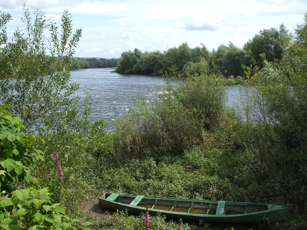
The shallows and a river cot at the Ormonde Castle at low tide (photo 2009)
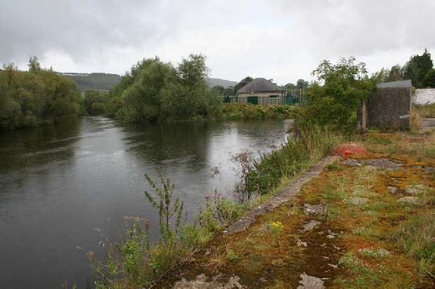
The disused harbour at Ballylynch

The Navigation Cut on the south bank of the river at Carrick
Once you exit from the navigation you can see the Ormond Castle and Dower House, built by Black Tom Butler, on the north bank of the river and from there to the Old Bridge you are in safe confines of the main harbour in Carrick.
From the foregoing it is clear that the river Suir is a large, tidal and easily navigable river up to Carrick-on-Suir. This conferred on the river the potential for great commercial activity in the period before road transport became fully developed. It also resulted in Carrick-on-Suir becoming a major distribution centre where cargoes were loaded and unloaded for further transport upriver to Clonmel or down river to Waterford.
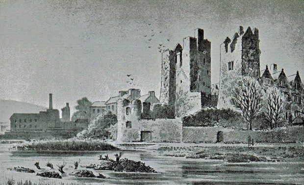
Old drawing of the Ormonde Castle, Carrick-on-Suir

The Ormond Castle (with Dower House behind) on the north bank of the river Suir at the entrance to Carrick
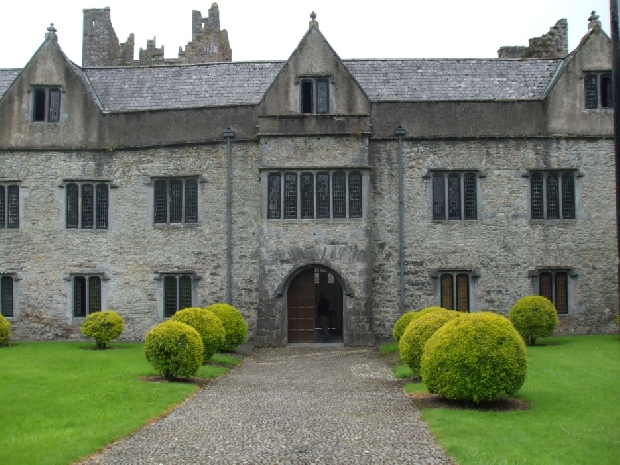
The Ormond Castle & Dower House, Carrick-on-Suir 2009
The Kilkenny Anthem
How sweet tis to roam by the sunny Shure stream
And hear the doves coo ‘neath the morning sunbeam
Where the thrush and the robin their sweet notes entwine
On the banks of the Shure that flows down by Mooncoin.
Flow on, lovely river, flow gently along
By your waters so sweet sounds the lark’s merry song
On your green banks I wander where first I did join
With you, lovely Molly, the rose of Mooncoin.
Oh Molly, dear Molly, it breaks my fond heart
To know that we two forever must part
I’ll think of you Molly while sun and moon shine
On the banks of the Shure that flows down by Mooncoin.
Then here’s to the Shure with its valley so fair
As oftimes we wandered in the cool morning air
Where the roses are blooming and lilies entwine
On the banks of the Shure that flows down by Mooncoin.
Flow on, lovely river, flow gently along
By your waters so sweet sounds the lark’s merry song
On your green banks I wander where first I did join
With you, lovely Molly, the rose of Mooncoin.
The Tipperary Anthem
Alone, all alone, by the wave-washed strand
All alone in a crowded hall.
The hall it is gay and the waves they are grand
But my heart is not here at all.
It flies far away, by night and by day,
To the time and the joys that are gone.
And I never can forget the sweet maiden I met,
In the valley near Slievenamon.
It was not the grace of her queenly air
Nor her cheek of the rose’s glow.
Nor her soft black eyes, not her flowing hair
Nor was it her lily-white brow.
‘Twas the soul of truth and of melting ruth,
And the smile of summer’s dawn
That stole my heart away, one mild summer day,
In the valley near Slievenamon.
In the festive hall, by the star-watched shore
My restless spirit cries:
my love,Oh my love, shall I ne’re see you more,
And my land will you ever uprise.
By night and by day I ever, ever pray,
While lonely my life flows on
To our flag unrolled and my true love to enfold,
In the valley near Slievenamon.

Salmon fishing on the river has always been important but not always legal
Leslie J. Dowley
lesdowley@eirco



![Aerial-View-Duncannon-Fort[1]](http://www.dowleyhistory.com/wp-content/uploads/Aerial-View-Duncannon-Fort1-620x419.jpg)

Great Info, as my Great Grandfather was Ml Dowley Boatman that lived Clareen St , Mill St , and Died in 1957 as my Grandmother was Nora Dowley Grace.
Thanks
Tom Grace